Monday, September 19, 2011

Another peak

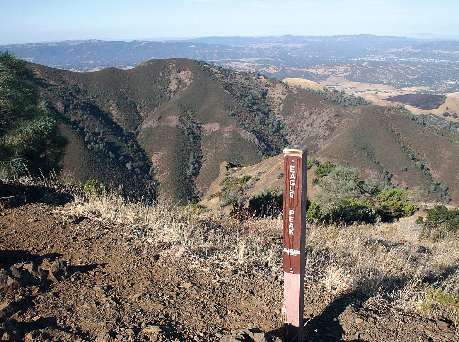
For a couple of weeks I had been planning my own little death march at Mount Diablo State Park.  I was going to take a solo hike on the one peak that hiking partner Alice and I thought was was the worst Diablo could throw at us.  I was going to take another try at Eagle Peak.  Early Saturday morning I started up the slope and a little less than four hours later standing in the parking park I was wondering what had been so wrong the first time.  This hike was easy.


Ok easy maybe is the wrong word for it but I was surprised at the end of the hike.  This wasn't the death march I had planned for, far from it.  No, this was more of a light  hike.  It was an 8-mile round trip with a climb of 2,347 feet.  The maximum positive gradient I faced on the trail was 20.5% with a total time for the hike clocking it at 3 hours 44 minutes.  All the nerdy numbers are courtesy of my Motion X GPS app on my iPhone 4 I carry on hikes.  Yeah this was supposed to a killer and I came up with a cake walk.  Well maybe not a cake walk.  It wasn't bad but this hike had its moments.


Way back in June of 2007 Alice and I tackled this very same peak and we both came out beaten.  The Snapshots column I wrote after the hike described it as a 14-mile all day adventure.  I remember we ran out of water about 2/3 of the way through the hike.  There seemed to be an endless amount of climbing along the steep arid trail.  So how can a one hike be so different from the other at the same peak?  I think I know the answer.


Looking at the hiking blogs and articles about climbing Eagle Peak most describe the same route:  Start at Mitchell Canyon Road, head to Deer Flat, take Meridian Ridge Road to Eagle Peak Trail up to the peak down to Coulter Pine Trail which takes you back to the parking lot.  Think of it like a big counter-clockwise loop up the mountain.  In 2007 we decided to take the steepest portion first and made the loop clockwise, starting at Coulter Pine Trail and working our way up the peak.  Many aching muscles later we claimed our victory on top.
So jump to 2011 and with Alice out of town for the weekend I had set my sights on a return trip up the trail.  Looking at some online article on the peak they mentioned a different route, a slight change that shaves miles of hiking and avoids the calf-aching climb up from Coulter Pine Trail.  The route I would take on Saturday would jump off from the Mitchell staging area, head out on Oak Road to Mitchell Rock Trail. that would lead me to Twin Peaks where it eventually joins with the Eagle Peak Trail to climb to the top.  From there everything was the same with a the return route heading to Meridian Ridge Road to Deer Flat and then Mitchell Canyon Road  to the parking lot.


Looking at the map it doesn't seem like such a big difference but on my new route I would get to see Mitchell Rock and Twin Peaks before I tackled Eagle Peak.  This also gives me claim as having climbed all the major peaks at Mount Diablo State Park as Twin Peaks had been the lone holdout.  So on Saturday with 5 liters of water and my old Canon Digital Rebel to test out a new camera strap I set out to climb Eagle Peak. The new route looked promising but I did forget to mention one thing, one little note everyone most people said about the trail I was taking.  It was bad,  I think the exact word that came up more than once was "treacherous".  And looking back at the hike they were absolutely right.


If you have ever hiked the trails of Mount Diablo you know there are two basic types of trail.  One is the wide dirt fire road trail.  These are easy to hike on, most you can hike two or three people abreast and the footing is generally good except for the occasional loose gravel.  The other type of trail on Diablo is whatever they can carve into the mountain side.  These trails are narrow, single-track dirt and rock, sometimes  covered in scree-a nasty combination of loose pebbles and dirt that make for slippery footing.  They are uneven, rugged and generally make for slow painful hiking.  While our hike in 2007 was longer and steep in one spot it was on these wide fire roads.  No such luck this weekend.  Welcome to the most treacherous and scary trail I have been on to date.


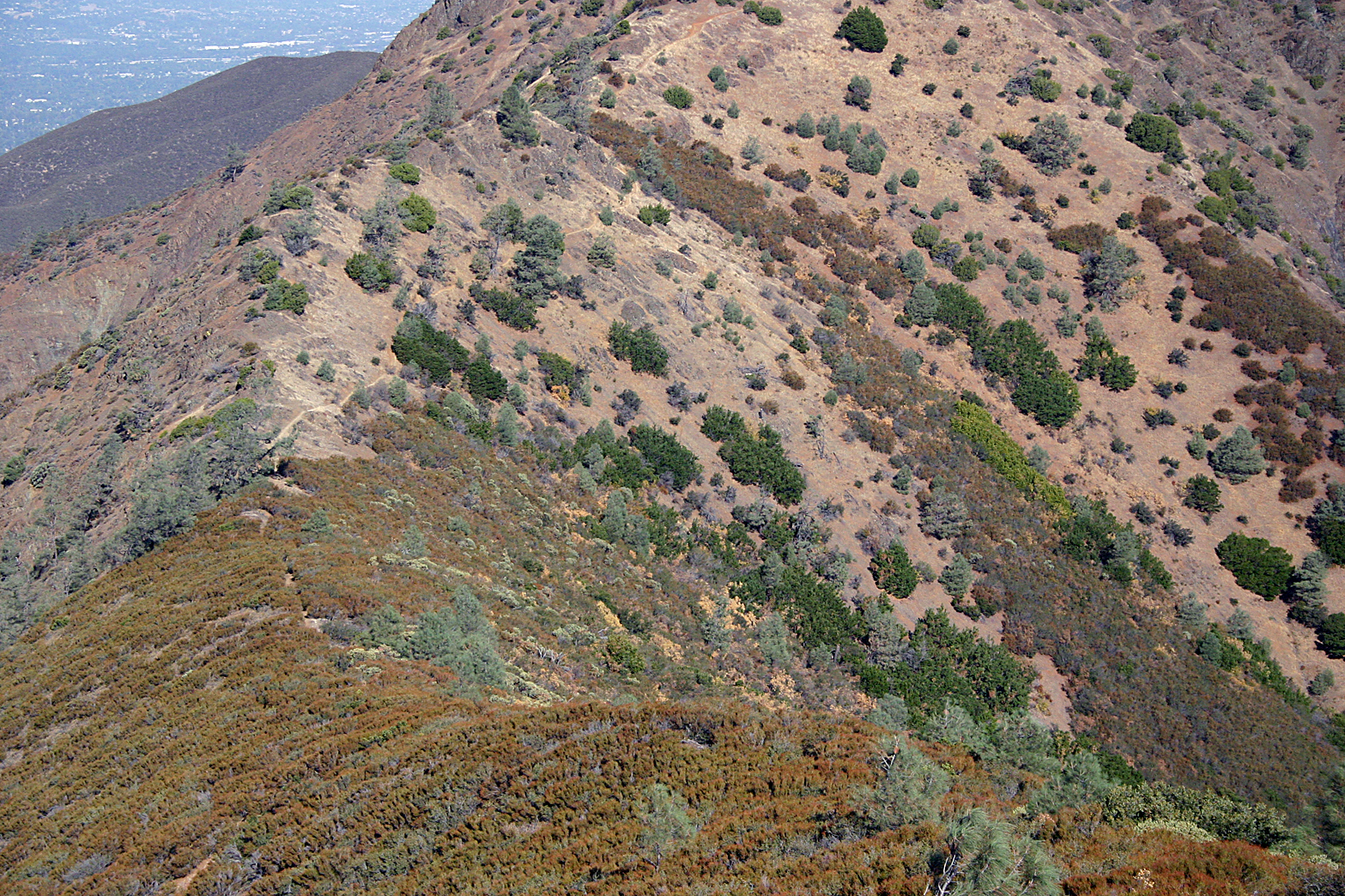
So imagine a nasty, narrow trail with uneven rocks and poor footing.  That is the entire trail on my way up.  I trade hiking distance for trail quality.  The trail is unrecognizable in spots to the point they put signs, lots of them to make sure you are heading the right way.  Sure it starts off  nice, a single dirt patch cut through the grass but as you climb the grass fades away and you are left with a rocky trail zing-zagging up the mountain.  The steep long climbs are replaced with rocky switchbacks.  The trail is overgrown in spots and branches, shrubs and anything that can scratches and tugs at you, scraping your pack, face and grabbing the hiking poles at every chance.


Seriously, this is not a fun trail.  It is not for beginners- it is not for some experienced hikers.  If you are claustrophobic this isn't the trail for you.  At a couple of spots I had to hike sideways as the trail was too narrow and the drop off to my left was a little intimidating.  I put my back against the brush lining one side of the trail and scooted across the narrow spots.  In some places I had to stop and think where would be the best place to put my feet and then the hiking poles.  This is a trail not for the timid.  You have to pay attention to stay safe on this trail for sure.

And to add insult to injury this trail is steep.  I still have to climb the same distance up the peak even if I am hiking a course six miles shorter.  With the trail troubles said and done it did seem to be an easier climb.  I think I was just more deliberate and paranoid where I was stepping.


I made a short stop at Mitchell Rock, a large rock formation that juts out from the trail.  If I would have had a hiking partner with me I might have ventured closer to the edge but with no one around to seem me fall and call for help I decided to press on to Twin Peaks.  The trail gets rockier the higher you go and at Twin Peaks it is a mess.  The trail began a roller coaster up and down route just past the Twin peaks and I began to get worried I had missed the trail in all the rocks.  Heading further the trail began another steep climb as I was officially now on Eagle Peak Trail.  A short distance later I found the junction where we had climbed from Coulter Pine Trail in 2007.  From here on out it would be the same hike as before.

Huffing and puffing I kept a steady pace up the rocks until I reached the plateau.  A sign marker made it official I was at Eagle Peak's maximum hight of 2,369 feet and I had made it up the hill in just one hour 45 minutes.  I took a break for water and pictures and then continued along the ridge.  The trail descends down from the peak pretty rapidly through some nasty scree rocks that had me pause and plan my steps. After the slow descent I began another climb for what seemed forever as I hiked to the Meridian Ridge Road junction.  I finally caught a glimpse and knew I would soon be downhill all the way to the parking lot.

Aside from one fall on the loose gravel of a very steep section on Meridian Ridge Road I made it through the hike unscathed.  I barely drank maybe a liter and half of the 5 liters of water i carried but it is always better to be prepared.  Overall it was a good hike, fantastic views of Mitchell Canyon and the surrounding area once you make it to the top.
I will probably add this hike to my list of must do once a year along with a summit climb.  The views are too good to pass up and I will take the trail's treachery in stride.  I may even get brave one day and try the old Eagle Peak route and see how I do on a solo 14-mile hike.  I'll get my death march in yet.

Saturday, September 17, 2011

Sunset

The view last night at Kimball High was too good to pass up.

Thursday, September 8, 2011

Never forget


For about 15 to 20 minutes, I guess I was like everyone else across the nation, sitting in front of the television in disbelief.
It took a few minutes for it to sink in what was really happening — it seemed surreal, the video of the airplanes, the buildings burning and the panic and confusion. I remember calling then-Editor Cheri Matthews and asking if she was watching the news, too, and what we should do next. It was a little after 9 a.m. Tuesday morning, Sept. 11, 2001.

Forget that everyone seemed to be in a state of shock and grief. That didn’t matter. Put that all aside for someplace later. I grabbed my camera gear, jumped in my car and headed to work in a world that had suddenly changed. News reports on the car radio were still filling in details of the terrorist attacks: two planes crashing into the World Trade Center towers, a crash at the Pentagon, and some reports of a downed plane in a field somewhere.
All the attacks were on the East Coast, but the ripple effect was about to strike us.
At the office, I remember we started planning our news coverage — we were already getting calls into the office. West Valley Mall was closed, shopping centers looked deserted and the streets were eerily quiet. I think my first assignment that day was someone who had called about putting an American flag up in front of their house.

There was an impromptu church service at noon, in which people sat in stunned silence. Some wept while they listened as church leaders tried to console them about the morning’s events.
Back at the office, I went over the photographs that were coming across the wire service. The pictures were horrifying — stark images of the destruction and death from the attacks. We did our best to sort through images that might be too graphic to publish as we kept a television on in a corner of the office, playing scenes of the tragedy in New York.
Somewhere in the middle of this, I had to drive to Highway 4 to photograph a fatal accident. Everything I saw that day was about death and destruction — it was getting to me. Somewhere around 10 or 11 p.m., my day ended. As I sat on my couch, the television newscasts kept showing the airplanes crashing into the towers and their collapse. I remember turning the news off — I had seen enough for one day.
But, to me, the worst part was still ahead.

We were thousands of miles from Ground Zero, and yet residents in Tracy could feel the effects in the wake of the attacks. That Friday, the city organized a prayer at City Hall. Hundreds of people gathered hand in hand and prayed for the victims of the attack and for peace.
The saddest moment was when the group sang “God Bless America” to end the prayer vigil. Some cried during the words — others buried their face in their hands. It was just too much for some.
Later that night, at a candlelight vigil at Lincoln Park, Tracy residents gathered to mourn the country’s losses. A man and his wife held an American flag as they sat in anguish.
In those weeks that followed, there was a new sense of patriotism. I covered more assignments of people with American flags than ever before. I was given a small plastic flag that still sits above my desk to this day. A section of steel girder from one of the towers and a crushed New York City fire engine stopped in Tracy as part of a nationwide tour. The girder and fire truck were met by Tracy firefighters in a somber ceremony commemorating their profession’s losses. Tracy fire engines to this day carry a decal remembering the terrorist attacks.

But as the patriotism swelled, so did our fear.
People were scared, and their fear turned everyday items into threats. Soap spilled on a restaurant bathroom floor was called anthrax, and hazmat teams were called in to investigate. Barricades went up at the entrance to the Defense Depot on Chrisman Road as Tracy was turning into a different world on assignment.
We covered prayer meetings of Islamic groups in Tracy that were feeling the fear and prejudice as a backlash from the attacks. It seemed like things would never be the same.
In 2001, the war against terror was launched. And in 2003, the war in Iraq began, and Tracy began suffering the ultimate sacrifice as its sons returned home as casualties of war.
I think there has been no worse thing I have had to do than visit the family of a grieving serviceman. It’s a hard thing to intrude on their loss and pain. Tracy bears the distinction as having one of the highest per-capita casualty rates in the country.
In the years that followed, I would have to visit more families and see more mothers grieve their children. God forgive me, sometimes I forget their names, but I can still remember the pictures I took at the processions, the funerals and memorial services as their families and friends grieved their losses. The photos of the names etched into a black granite wall that chronicled our sorrows changed, as the list of names grew longer.

My Sept. 11 assignment never really stopped, I think. Through the years since that day, I have seen the city residents mourn and remember the events of that terrible day together.
My assignment continues this Veterans Day, as the name of David P. Senft will be added to the Tracy War Memorial, remembering his death in Afghanistan.
It was 10 years ago. It seems so long now — 10 years and many tears ago.